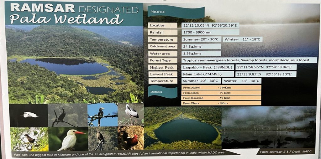
Pala Lake
Location: 22°12’10. 05″N. 92°53’20. 59″E
Rainfall: 1700 – 3900mm
Temperature: Summer – 20°- 30°C Winter – 11°- 18°C
Catchment area: 24 Sq. Kms
Water area: 1.5 Sq. Kms
Forest Type: Tropical semi-evergreen forests, Swamp forests, moist deciduous forests.
Highest Peak : Liapahlô – Peak (589MSL) 22°11’58.96″N 92°54’58.96″E.
Lowest Peak: Main Lake (274MSL) 22°11’9.85″N 92°53’18.13″E.
Temperature : Summer – 20°- 30°C Winter – 11°- 18°C.
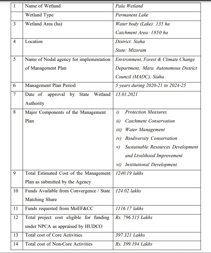
Pala Tipo (Pala Lake) is the largest and biggest lake in Mizoram, northeast India. It is located near Phura village in Siaha district, Mizoram, India, within the Mara Autonomous District Council (MADC) in the southernmost district of Mizoram, India.
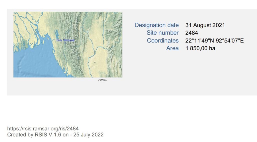
Site : Pala Wetland
Designation date : 31 August 2021
Site number : 2484
Coordinates : 22°11’49″N 92°54’07″E
Area : 1 850,00 ha
Source: https://rsis.ramsar.org/RISapp/files/RISrep/IN2484RIS_2207_en.pdf
Source: https://rsis.ramsar.org/RISapp/files/5366956/documents/IN2484_mgt210817.pdf
Pala Lake (Pala Tipo) Distance :
Aizawl City to Pala Lake (Pala Tipo) : 360 Kms
Siaha Town to Pala Lake (Pala Tipo) : 97 Kms
Kaochao Village to Pala Lake (Pala Tipo) : 59 Kms
Phura Village to Pala Lake (Pala Tipo) : 6 Kms.
Pala Tipo (Pala Lake) is the biggest lake in Mizoram and one of the 75 designated RAMSAR Sites (of international importance) in India, within Mara Autonomous District Council (MADC) area.
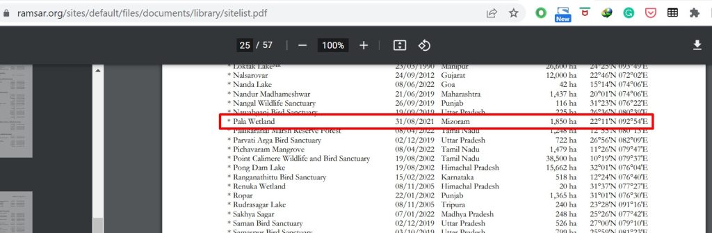
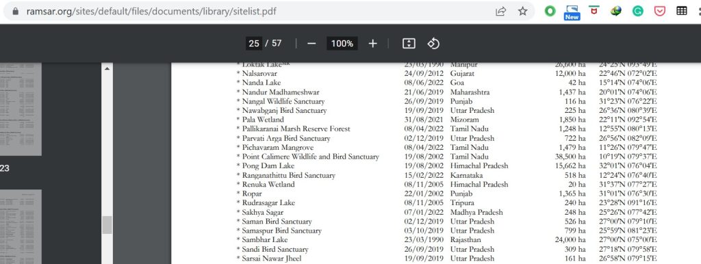
Site : Pala Wetland
Date of designation : 31/08/2021
Region, province, state : Mizoram
Area : 1,850 ha
Coordinates : 22°11’N 092°54’E
Source: https://www.ramsar.org/sites/default/files/documents/library/sitelist.pdf
Pala Wetland on Ramsar Sites Official Website https://rsis.ramsar.org/ris/2484